Manětín

Grateful for another autumn day we decided we should explore more of the interior regions of Czech Republic. The drive itself was worth it as it went through more agricultural areas than urban. The region is covered with hops fields and you can stop in the town of Krušovice (https://krusovice.cz/en/historie) to try their beer which is sold all over the world. In fact it is a couple hundred years older than Pilsner. Michal speaks fondly of his time working in the hops fields as a teenager with his classmates. If you want to see what that might be like watch the movie called Starci na chmelu (Old Hop Pickers) with English subtitles (renamed Green Gold for english version). This a musical comedy about group of students picking hops over the summer under school supervision dealing with adolescent morality and bureaucracy.

The best parking is right in front of the castle Manětín. We had our lunch in the castle restaurant and walked around the grounds, but didn’t go inside. However, it does look very pretty and offers tours in English in case you are interested. https://www.zamek-manetin.cz/en/

After a ride uphill at the point 2 you may feel like you lost your direction until you see the tourist mark across the wide field. After that point the ride is very comfortable up to the point 21 where the difficult ride uphill to point 22 starts. There are two points on which you should definitely consider leaving the bike behind and walk uphill without it. The first is the ruin of the castle Nečtiny (15) and the second is Špičák (22). It is worth to climb to top of Špičák to enjoy panoramic view of the Manětínsko.

Given it was somewhat cool weekday we basically had the whole ride to ourselves. However, we ran into the značkaři for the first time ever. There were a nice couple painting the trail markers on the trees and were happy to answer questions about their work. The Czech hiking clubs take care of this task for over 70,000 kilometers of trails (here, but also in Brasil, Albania or Romania). We learned that the metal signs can be placed only on the dead wood or on birch tree and all marks are renewed every 3 years (always by different volunteers), and follow very strict requirements for the color and size of the mark.

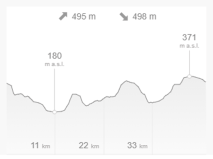
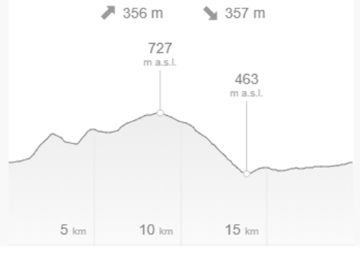
https://en.mapy.cz/s/pepahejoru 42 km elevation gain 758 m (optional)


Zbečno – Central Bohemia

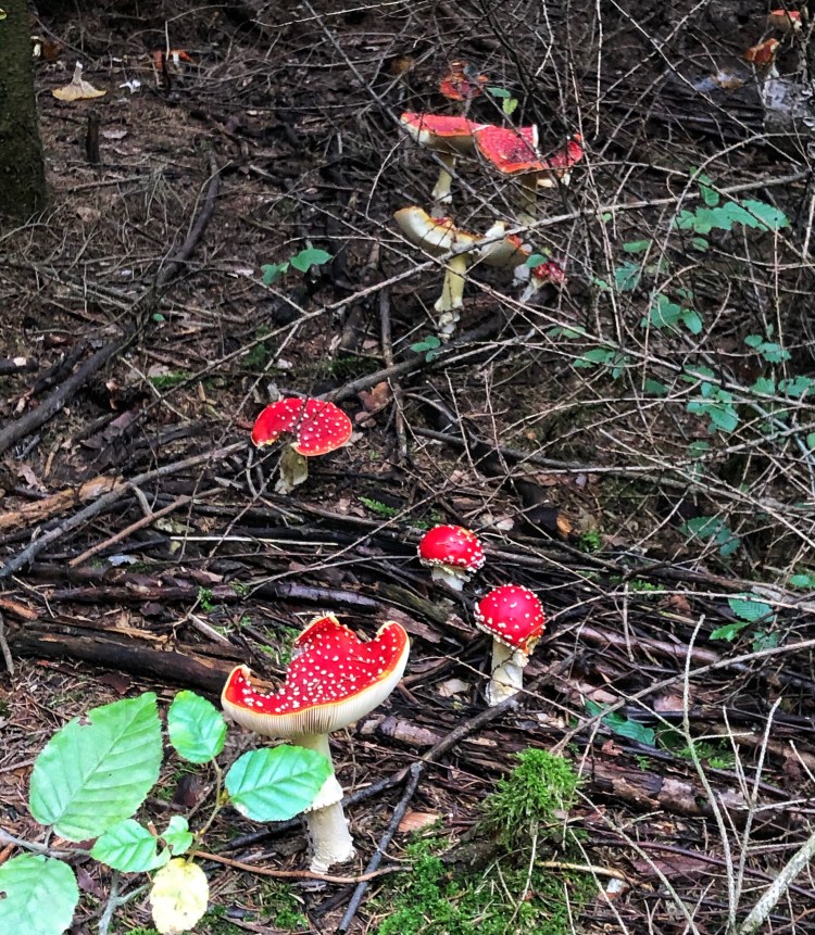
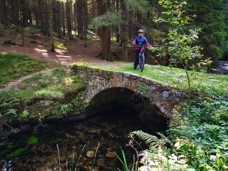
One of the more well known castles to visit not far from Prague is Křivoklát, but if you don’t make a lot more time for some hiking or biking you will miss the beautiful Křivoklátsko, a landscape protected area. Because it was the hunting grounds for the kings and princes since the Middle Ages it is very well preserved. And its even more lovely on a warm day in October. The photos below show that mushrooms (poisonous and edible are growing well). The red fruit in one photo is rosehip, ready to be picked for making your rosehip tea.

We started from a small village named Zbečno. The parking for this ride we found on the square next to the post office. Part of the road was closed in front of the square due to some reconstruction which will be probably done in couple of weeks.

After reviewing our plan we made a last minute decision to avoid riding on the main road up the hill. Instead of riding from point 2 to 4 on a windy road with cars we decided to take a yellow marked tourist path straight up. The 350 m from point 2 to 3 were a super steep, narrow and basically a non-rideable uphill fight. Fortunately one perk of our E-bikes is the ‘walk mode’ which helps to walk the bike uphill. You can imagine these bikes are heavy so going straight up a slope helps when it can pull its own weight.

From point 8 to 14 we followed the red marked tourist road which led us through the forest and in some places it was a VERY narrow path along the fence of Lány obora (game reserve). This game park was established by the Wallensteins back in 1713. Today it belongs to the environmentally protected area of the Křivoklát region. The 3,000 hectare game park is fenced in and is not open to the public. It serves in particular to protect pure-bred game (deer, fallow deer, mouflons and sika deer). The idea of arranging hunts for distinguished guests was also one of the reasons why Lány was chosen in 1921 as a country seat for the Head of the Czechoslovak State.

After point 14 the ride was without major challenges, maybe with the exception of path around point 24. You must not pay attention to the sign “Nepovolaným vstup zakázán” (entrance forbidden to those who were not called), because obviously you were called to follow red marked tourist sign.

https://en.mapy.cz/s/luzuberero 38 km 638 m elevation gain

Stříbrná Skalice

When the autumn days are nice, Czechs refer to it as ‘babí léto’ which means grandmother’s summer. It is what we know as ‘indian summer’ and this first day of October was definitely a nice day. This trip is only a 45 minute drive south east from Prague and near the Sázava river. There were no castles or ruins to visit, which meant we had the forest basically to ourselves. In fact I was super excited that I went around a corner just in time to see a young deer with horns (only the 2nd one I saw in the wild this whole summer). In the meanwhile, back at the cabin in Montana we have several living nestled up against the cabin door. I also saw a wild boar running into the brush. 

We started in the town of Stříbrná Skalice. The old name ‘Rock of the Silver Mountains’ shows that silver had been mined in these places since ancient times.  We parked in the main square so we could indulge in some coffee and sweets before the ride. There is transportation to this point to hike into the forest, but if you hike more towards the Sázava river, you will be able to wander through the many ‘osada’s (summer cottage communities) and take in all the pretty gardens.

Our route was not particularly steep and we didn’t have to conserve the battery.  However, if you don’t like bushwhacking with an electric bike or lifting it over logs then you may want to make a few different choices.  As you can see the map is like two figure eights because it wasn’t a large forest, but it was worth it as you can see the rolling Czech hills at a few different points. Towards the end we passed a gorgeous little lake with what looked like a nicely landscaped island in the middle. Apparentely this can be reserved for weddings.

We also rode through the small village of Vlkančice and had a quick stop for a geocache. And what you won’t find on Wikipedia is the story about how the village got its name. They say it came from a sheep herder in the distance who saw a young girl named Anna and a wolf behind her. He wasn’t close enough to help her so he yelled ‘Vlk! Ančice!’  Which just means Wolf! Anna! And they put the two words together for their town.

So, a little more about the road choices. If you are into some adrenalin, you may try the shortcut 15 to 16 – it is barely visible path going through a lot of vegetation which will be catching your pedalling legs and at the very top will completely disappear, but you will already see the road which you cannot miss. We found this connection after trying many alternatives which were much worse than 15 to 16. However, you can get to the point 17 by following the regular road. Ride from point 17 back to the road is a nice path trhrough the forest. However, path from point 20 down to the pond Propast (Abyss) is very challenging and at this moment you will have to climb over two fallen trees. After that you will be faced with a very steep slope down. Some bikers may ride it, but we were not inclined to do that. Alternatively, you may ride on the road back toward point 17 and turn left on the road downhill and reach the pond at point 23, where you can find a restaurant Propast (during winter season opened only Fri-Sun). If you choose to ride along the pond, do not miss a half finished – half abandoned “castle” building.

https://mapy.cz/s/focedofamu 32.5 km 474 m elevation gain

Železné Hory – Seč

Železné Hory or Iron Mountains is about two hours east of Prague and not too far from the more touristy town of Kutná Hora (known for its old silver mines).  These mountains are not particularly high which made our ride quite easy and relaxed through the forests. 

We did this ride in September when most of the smaller refreshment stands that cater to hikers and bikers were closed.  However, we find a place that served a good lunch at the Kongres Hotel Jezerka which I would consider staying at next time if we went overnight as they had a variety of saunas and wellness options. I definitely would consider the returning to the Seč Reservoir to swim in the summer with plenty of beaches and clean water. We also came across a small Jewish cemetery with views of the lake, although I believe most of the cemetery had been relocated somewhere else. In fact I think the whole area has plenty of things to do such as visit the castle ruins of Vildstejn, Oheb or Lichnice, or castles Třemošnice, Hoješín, Klokočov or Seč.

Our ride began in the town of Třemošnice which was known for both ironworks and the limestone quarry’s nearby and has a very industrial feel to it.

Our trip ended in the Hedvičina Valley which is quite beautiful with a stream running through it. You will see a huge building which is the family run Kovolis company. For two hundred years they’ve been in business and are known for aluminum castings worldwide.

There are several points where you should pay attention to your riding, or avoid riding and prefer walking the bike. The first is between points 2 and 3. It is rideable, but it is coming after sharp turn left and you should be ready to fight bad surface road straight uphill. If you will take the shortcut from 5 to 6, you will be going in the wrong direction of the one way street. The real test of your skills and nerves comes between points 8 and 9, where are several stretches completely unrideable. You can avoid this part going from Hoješín to Klokočov on the road and then continue on yellow tourist mark to point 10. You will have to cross the bridge over Chrudimka (see the pictures below), so be ready to carry your bike upstairs. At point 10 you can decide to ride along blue tourist mark to the left (but we did not “wet” this option, so cannot comments on that choice), or you can continue on to join cycling route number 4115 and follow it to point 12. We have chosen a shortcut from 11 to 12, which was bikeable, but very tiny easily missable not often travelled path. After this point the ride is a smooth sailing back to Třemošnice.

https://en.mapy.cz/s/bokajerusa 31 km with 550 m elevation gain

Šumava – Černé jezero

Feeling fortunate for the extended summer weather into September we made another trip back to Šumava National Park.  Although its only a 2 ½ hour drive from Prague it seems more efficient to spend the night there to make the most of the warm days. This time we stayed at the northern end of the park in the town of Železná Ruda (means iron ore).  We decided to stay in a hotel located on the southern slope of Pancíř Hill rather than in the village. We can recommend the hotel Orea Resort as a great location https://www.resorthorizont.cz/hotel/.  They were extremely conscious about the safety of their guests and disinfectant was everywhere. The food was decent and the guests all wore masks. We strongly suggest you make the hike up the hill (or use chairlift if its running) to take in the sunset on Pancíř about a 20 minute walk.

We started this ride from the hotel and knew that we would have to be conservative with our batteries as it was mostly downhill in the beginning. The thought is always in our heads that what goes down must come up and with these heavy bikes we don’t want to ride on 0% battery!

The forests of Šumava are much like all the Czech forests and its easy to get mesmerized by the different trees and how the light reaches the forest floors. I especially love the forests that aren’t so logged and planned with a variety of trees (oak, fir, beech, spruce)  But one of the problems Šumava has had to deal with is connected with bark beetles, and there is heated debate about how to treat them.

The ride is planned from the parking lot at Špičácké sedlo, which is a paid parking lot. After reaching point 2, you will have a long ride down to Zelená Lhota, which is the only place to get any refreshment on this trip.

An important attraction on this trip is “Černé jezero” (Black lake) with its natural beauty, nature specialty, and dark history. It is the only lake in which a relict from the ice age, the critically endangered Šídlatka jezerní (Isoetes lacustris) is still surviving. As for the dark history, in the year 1964 the communist secret police pretended that it recovered secret documents from the times of Nazi occupation of Czechoslovakia. Some political figures in Germany resigned or even committed suicide as they were afraid of the secrets from the war times would come to light.

The ride can be accomplished on any type of bike as the road was not really challenging, with the exception of a battery usage.

https://mapy.cz/s/mujoluvujo 43 km with almost a 1 km elevation gain

Once you visited Černé jezero, you might be interested in Čertovo jezero (Devil’s lake) which is a little more than one km away. Interesting fact about these two lakes is that the streams flowing from these two lakes end up in different oceans due to the continental divide located just between them. If you have enough battery, you can do this trip the same day, or you can use the map given lower for a short trip (8 km) swinging by the beaver dams (point 3) in Železná Ruda. Riding on the yellow tourist mark from point 3 to 6 may require carrying the bike for a short stretches. For this trip you can use the large parking lot on the side of the road down from Špičácké sedlo.

https://en.mapy.cz/s/petepasovo 8.6 km with 268 m elevation gain

Šumava – Prášily

On the way to the start of our trip in Prášily and not far from the hotel where we stayed in Železná Ruda is an area taken over by beavers (bobr in Czech). If you are interested in the Eurasian beaver’s civil engineering you can get a unique view of little towns full of beaver dams and lagoons. We also took a short side trip by car to the Velhartice Castle from the late 13th century. It was worth the visit as you can see by the photos below.

A convenient starting point for our next ride we found in a small village Prášily. The first six kilometers are a straight uphill struggle. After point 2, the highest point of the trip, you will enjoy a gentle ride on well maintained roads. The only exception is a short uphill stretch between points 5 and 7. After point 7 you will arrive at Tříjezerní slať where you can take a break and visit this moor. Most of the Šumava moors are not publicly accessible – they are located in the highly restricted protected areas.

From the point 4 to 6 you will ride through the beautiful valley of Roklanský potok and reach the touristy village Modrava with several restaurants, a brewery and even live kangaroos in an enclosure. If you are not hungry yet, you can turn at Rybárna (point 5) and go directly to point 7. After that you will be riding mostly flat or downhill along the Vchynicko-Tetovský channel built for logged wood transport. The bridges over this channel are protected as technical memorials and are worth stopping and getting a closer look. At point 8 you can take a shortcut to point 10, or you can continue through Srní where you can find opportunity for refreshment. After point 10 the bike path follows the road through the mixed forest all the way to the parking lot where you may have started your trip.

https://mapy.cz/s/gogejepehu 42 km with 584 m elevation gain

Jevany, Central Bohemia

This ride was one of the easy ones and quite uneventful – with the exception of very close encounter of Polly’s bike with the car making very sharp turn uphill. Luckily brakes on both sides worked well. She claims it was her lucky feather. The town of Jevany and the forests above the ponds are a popular destination for weekend walks and rides, so we cannot say that we did not meet anybody there. The berry pickers and mushroom hunters were still out late in the day.

During this loop you will be passing through Mukařov where you can see the senior center with the name of Cardinal Beran and you may be wondering who he was. Well, he was one of the people who was persecuted first by nazis during the second world war. Cardinal Beran spent three years in the Dachau concentration camp. As soon as the communists gained power after the war, he was put under house arrest in Prague and later in multiple locations around Czechoslovakia. One of these locations was the village of Mukařov. He was archbishop of Prague and since 1965 the Cardinal. He was forced to emigrate (not allowed to return to Czechoslovakia) to Rome, where he died in 1969 and was buried together with 91 popes in St. Peter’s basilica. His remains were moved to Prague only in 2008 and are now in St. Vitus’ cathedral.

Continuing onto the nicest part of the ride is between points 14 and 15. This path is called “Krásné vyhlídky” (beautiful views). A good spot for taking a break is bistro “U Hastrmana” (point 11). Before you turn uphill from there, do not forget to look down to the impressive quarry on the left. At the point 15 you will join “Mikešova cesta” (Mikes’ path) named after the character from Josef’s Lada book “Mikeš” – about a cat which could talk and eventually became the director of a circus.

The part of the mapped path that is labeled red meaning ‘bikes not allowed’ we think is a glitch of the online maps we are using (mapy.cz) since there were no signs saying it is forbidden. The maps from http://www.cykloserver.cz/cykloatlas show these parts as totally bikeable (see the picture below.) If you are already tired of biking, you can take the road from the point 16 downhill to the finish. You can also stay on the road from the point 21 to the end. If you want to ride along the Jevanský rybník, you can turn at the point 22 and walk your bike down to the little bridge and continue riding. Do not try to find the path from 21 to 22 – it simply does not exist.

https://mapy.cz/s/befepahevo 36.6 km 393 m elevation gain, reasonable even for the regular bikes

Beroun – Žebrák

Many of our bike trips are fairly close to Prague and Beroun is no exception. This town is only a quick 30 minute drive from the center and easily reached by train as well. Beroun has everything it takes to make it a nice visit even without biking.  In former times it used to be an enclosed fortress and you can still see the remains and ruins of the fortress walls just along the outskirts of the city center. The two main tower gates which were once connected to the fortress walls still stands and there is a nice big square inside. After seeing the remains of the walls, you can go and check out 3 bears that are residing in Beroun. These bears are in care of by the city as “the bear” represents the city.  The annual Beroun pottery market is huge and worth a visit. Unfortunately this year it was cancelled due to covid.

The area itself is rolling hills with deep valleys. So we paid closer attention to our battery usage. Michal and I have a deal that once it reaches 50% battery on his he should make a decision to trade with me or live with the consequences! It makes sense that being a smaller person I use about 15% less than he does.  Michal is the type of person that will run a car on fumes and I will fill a car up at ¼ tank. So he knows that he cannot trade batteries with me at less than 50%. Today I made the exception as he gave me 49%.  The trip was 47 k total and there was about 30% left on the trade. 

We parked near the river and bridge into Beroun as there is plenty of free parking. The first 9k goes along the small Litavka river and is a paved road. Its nice but you will hear the interstate that runs parallel until you get to Zdice. We had a late lunch at U Zímů (https://www.restauraceuzimu.cz/) which fits our requirements of sitting outside which we have done the majority of time over the past 6 months. This building was mentioned as a farmstead from the 1600’s.  Zdice also has a small town square to look at.

After lunch we continued through some fields where you will see at a distance the Točník Castle and soon after you will see the ruins of Žebrák castle. They are so close together because King Wenceslaus IV had one as his private residence and when there was a fire he thought he needed a fortress castle nearby. Well, why not????  They are both worth the visit and it is always good to get two castles per trip at least.

After leaving the little villages (point 5) the trip gets a bit quieter through a nice forest on a dirt road. And another little village and more forest that is behind Beroun which is quite lovely looking over the town. We ended up back in the square of Beroun to look for a geocache that has eluded us for years. We have been there over five times and still cannot locate it. In fact, there were several other people searching and annoyed with the owner of this cache as it is rumored he changes the camouflage often to keep people coming back. 

Speaking of caches. There is an amazing series called the Žebrácky stroj casu. Each one of the 26 hides is representing some important day in history. They are not difficult to find, but the creativity of the guy that set up scenes from history to put it in a small box is really impressive. We recommend this series to families and anyone who can really appreciate the cleverness.

https://en.mapy.cz/s/lazapuvesa 47 km with 623 m elevation gain. The part marked “No entry of bicycles” is a small bridge over which you should just walk your bike. The only part of the whole trip where you should be very careful with your riding is between points 17 and 18 (just after the two UFOs on the left).

Kbely, Prague

Sometimes choosing the destination first and then planning the route around is the best. This time we decided to have lunch at the Kbelsky Pivovar (http://kbelskypivovar.cz/) in Prague 19. Unlike the previous Únětice brewery we visited which was founded as early as 1557. The Kbelsky brewery is very modern and new (opened in 2019).  They say they use the same traditions as Count Černín in 1758. Michal approved the beer (with the funny names like 12 pilots, 13 ravens, 14 may flies) and we enjoyed our lunches very much.

If you are thinking of testing an electric bike or just want to rent one in the city we recommend both of our city routes. Starting from home on Letná park and rode over to Stromovka park with the intention of crossing the river there (point 3). We have taken this route often in the past as a way to get to the zoo on the other side.  Three years ago the pedestrian bridge collapsed and people have to use a boat that takes them back and forth.  We were surprised to see that the new bridge is almost finished and it will be nice not to wait for the boat every 30 minutes.

The route continues up the river along side the famous Prague Zoo. The zoo had been destroyed during the 2002 floods and some animals drowned. Since the renovations it is one of the better city zoos. On weekends this paved route is very busy with walkers, rollerbladers, and very fast bikes, so we were happy we were going midweek where is was very relaxed.  There are plenty of food and drink spots along the way.  You will also see a few more points where you can take the boat back across the river and make a smaller loop. They will operate pretty consistently throughout the year.

Once we got to the village of Klecany we headed up the hill away from the river with some road and forest trail intermixed. At the top we headed through the Premysleni village and right before the main interstate there is a small tunnel to the other side. Just watch your head going through!

The terrain becomes flat and goes through agricultural fields with the city backdrop and you feel really outside of Prague. Once we arrived  at the Lesopark Letňany (point 10) I saw what Michal had been telling me.  He had been trying to convince me to try these little parks with bumps and turns to ‘practice’.  I had always resisted but this place was wooded and it seemed ok to go in. Little did we know its like a crazy maze of switchbacks and sharp turns. We should have read the sign with instructions on how to go before we entered! Once inside we realized we didn’t know if we were going the right way, we started taking short cuts and really got turned around. One short cut had thorns that caught my finger and tore it. We are used to little cuts and scratches so we carry a first aid kit which was again very handy to clean up, disinfect, and bandage and we were back on the trail. After we exited we realized there was also a ‘baby trail’ and that it would be better for our skill level! Letňany Forest park is quite large and good for everyone looking to get out and have a good walk. We definitely plan on returning. I am determined to ride the lesopark with more skill.

The restaurant isn’t far from here (point 12) and for those wanting to just come to try lunch can take the metro and bus.  After our bellies were satisfied we headed back towards home.  Not far from the brewery there are a few museums along the road. We were too busy to go in but it looks interesting. The Aviation Museum Kbely is known as one of the largest air museums in Europe. The The National Memorial to the Heroes of Heydrich Terror is located in underground of Ortodox cathedral of St. Cyril and Methodius in Resslova street. The military technical museum – for more information go to http://www.vhu.cz/english-summary/

Going back into the city from here is not as pleasant as you ride along busy roads (sidewalks usually) and get back across the interstate. Use the pedestrian crosswalk for safety. Once you are in Vysocany (point 14) it becomes a nice city bike path. This neighborhood and into Karlin are busy but it feels comfortable with the wider paths. The Karlin area suffered severe damage in the 2002 floods, but the renovations and modernization make this such a beautiful area to live if you aren’t into ‘old villas’. We crossed back to our side of the river by using the Čechův bridge. This is the point of the trip we would dread in past years but with electric bikes we shoot straight up the steep hill and the 43k ride is over.

https://en.mapy.cz/s/fusesaboda 43.5 km 230 m elevation gain

Prague parks and Únětice

We don’t usually start a bike ride from our house given we live in the center of Prague and really hate the traffic but we wanted to go for lunch in Únětice brewery. It turned out to be a 45 km ride through a surprising number of different parks of Prague and surroundings. This ride had plenty of diversity from city, suburbs, parks, and forest.

The Únětice brewery (https://www.unetickypivovar.cz/en/) was built in 1710 and its beer was at one time smuggled into some pubs where it was sold as genuine Pilsner beer. After 60 years of neglect and sitting idle, the brewery was renovated in 2011 and quickly gained the reputation it always deserved. We recommend to plan around a mealtime and visit the brewery restaurant (point 16) to eat and taste the beer.

You can start at any point on the map. We started at Letná park where we live, but if you are arriving with bikes in a car, some reasonable parking areas can be found at Strahov (starting point) or there is some paid parking nearby (point 2) where it should cost 20 crowns per day.

The first structure you will see is the Strahov stadium (starting point) which is one of the biggest stadiums in the world – it can fit 9 football pitches inside and host 250 thousands spectators. It was built in 1926 for “Sokol” (synchronized gymnastics) and at this moment it is slowly deteriorating since nobody knows what to do with it.

From there you will ride through several city parks starting with Petřín, which is a forested area with view of the castle. It may be busy during weekends, so be careful about the pedestrians. If you want to avoid crowds, you can ride through the top following the bike path number A32 to Pohořelec (point 4). At Hradcanske Namesti (point 5) you may enjoy the classical Prague view – especially right now without hordes of tourists due to Covid-19. Next you will first ride through the parks Chotkovy sady and Letenské sady. ‘Sady’ means park. Letenské sady (also known as Letná) contains the location of infamous Stalin statue, now used as a skating park (point 6) as well as the best beer garden in Prague is at Letenský zámeček (point 7). Then you cross into another beautiful park called Stromovka and follow the Vltava river downstream. At a certain point, depending on the wind direction, you will smell the waste water processing plant. You can even enter and visit the “guts” of the old waste water processing plant which isn’t smelly (point 9), . The plant is considered a technical curiosity and has guided underground visits 5 times a day (https://www.staracistirna.cz/en/).

On the cliffs to the left from the river is the ruin of Baba – and more surprisingly – a big HOLLYWOOD sign that we hadn’t noticed before. Turning left from the river you will ride through natural park of Šárka-Lysolaje and arrive in the neighborhood of Suchdol. From there you enter natural reserve Tiché údolí (means quiet valley) and follow it uphill to the brewery in Únětice (points 14 to 15). From there you have a choice of following upper trail (yellow tourist mark) or lower trail along the stream (points 18 to 19). We believe that yellow marked trail is easier, but we chose the lower trail which was more scenic, but from the point where it connects to the red marked trail it was a quite challenging uphill struggle to the crossing at Saint Juliane – a surprise statue in the middle of the forest.

Next you will ride through the natural parks Tichá and Divoká Šárka (point 22) with possible refreshment stops at restaurant (point 23). This is the location of a an old tale of a famous woman warrior named Šárka. The story is she killed herself after betraying her lover (see the picture in the pub). After crossing the major road Evropská you will enter another park called Hvězda Obora (means star game park). The strange star shaped building is another place for a coffee stop and sometimes there is an exhibit. After exiting Hvězda Obora you will cross another main street and go through another huge park called Ladronka. This park has bigger paved biking and rollerskating lanes and is quite busy. They also have a frisbee golf course which we’ve played a few times.

https://en.mapy.cz/s/jatemucage 45 km with almost 500 m elevation gain.

Radotín and Berounka – Central Bohemia

Well, if you want to start your bike ride on an appropriate place, then start at the Ski and Bike Centrum Radotín (http://www.skiservis.cz/). They will let you park at their parking lot and you should definitely visit their warehouse (especially if you want to drop a lot of money on the next bike of yours) or have a lunch at their cafeteria. You can also test your biking skills on their test bump road.

From there you will ride along Berounka river on a nice bikepath up to a bridge in Dolní Mokropsy (2). If you are scare of heights, crossing this bridge may give you goosebumps as the bottom of the walkway is nicely see-through. Nice and easy path will turn into an uphill and between 3 and 4 it will turn to the super-uphill. Make sure that you change your gear well ahead the sudden turn to the right after the bus station. You can also follow the road to point 4 – longer but much less steep.

After riding down to very close to the highway, you will be riding through nice forest which may seem like a forest in some of Czech mountains. The stretch of the path between points 6 and 7 will surprise you with some ups and downs which you would not expect here. When you arrive in Lipany, pay good attention to the downhill road between points 10 and 11 – we rather walked our bikes for a little bit.

After riding through the big golf course and crossing another bridge you will be back where you started. It is about 30 km with 324 m elevation gain – very easy with the exception of points mentioned above.

https://en.mapy.cz/s/narerukora

Konopiště, Central Bohemia

Konopiště is about an hour drive from Prague and is one of my favorite castles. The castle is a four-winged, three-story castle located in the village of Konopiště, which is now a part of the town of Benešov. It has become famous as the last residence of Archduke Franz Ferdinand of Austria, heir to the Austro-Hungarian throne, whose assassination in Sarajevo triggered World War I. I know my brothers who hunt in Montana would be blown away by the amount of trophy animals Ferdinand killed and have hung all over the castle. They have 3 different tours for the different floors in English and it is very worthwhile to visit. The surrounding grounds are beautiful with plenty of walks and hikes nearby. You can even play frisbee golf in the gardens or paddle board in the lake near the castle.

This ride is only for the hard core bike enthusiasts. To do this with E-bike adds a lot of trouble to the trip as you will have to carry your bike for about 200 to 300 meters on very slippery rocks and roots along a creek. The trail is very pretty but I would consider it even challenging to some walkers. Even so we were passed by six other bikers during our struggles but they were NOT on e-bikes. In fact this really isn’t a ride we would recommend if you can’t carry your own bike for a while. There were other sections on the route in which we decided to avoid injury by walking it. If you decide to try this route and don’t get hurt and are still smiling at the end let us know.

The ride starts at the parking lot of a castle Konopiště. It does cost to park there but we liked having some restrooms and restaurant options for after the ride if we wanted. During the ride, struggled a bit finding the mapped path due to overgrowth. We strongly suggest long pants for this ride unless you love the feel of stinging nettles that don’t fade until evening. By the time we got hungry for lunch we had to ride another 2 km out of our way to a place called Hostinec Antonin Bartak (point 7) which we can recommend for good food and lemonade.

So, be ready to carry your bike between points 4 and 5 and ride very carefully up to “Měsíční údolí” (point 6). If you want to make your decision based on more evidence, check the pictures below. At point 10 you will have a choice to go through a quarry (point 10 to 11 – about 300 m, which should be fine on the weekend when there is no work going on, but during the weekdays we would recommend either to ask for permission to go through or ride around this place and join the route at the village Žíňánky). Another sketchy part of the ride is the connection between Červený Dvůr and road 110, where the map will be sending you through the old very overgrown path. Just turn to the left and follow the tracks at the edge of the field.

After riding through Benešov and crossing very busy road E55, you will be rewarded by riding through the park of the Castle Konopiště. Close to the end do not miss the turn 22 to 23 which will lead you to the path aroud the pond with nice views of the castle.

https://en.mapy.cz/s/kucoledoba

Brdy, Central Bohemia – Stožec

Stožec peak is only 635 meters and if we weren’t looking for a geocache we might have missed it. As a starting point we selected the parking lot at the top of the Brdy range. You should be there early morning during weekends to get a spot since many bikers and hikers start here.

This 32k ride was probably the most interesting ride in the Brdy Mountains according to Michal. He liked to see the edge of what was once a rocket defence military installation. Two rockets were always ready to be fired at the targets at the “west”. The goal of the soldiers stationed here was to get ready and fire all 35 rockets in 30 minutes after firing the first two since it was not expected that the station would survive longer than that… So much of history…

But you would have to be ready for some borderline stuff if you want to see the installation today. After passing the top of Stožec (point 6) the asphalt road will lead you to the entrance to the military area. Just before reaching the gate the tiny path will turn right and follow the area along the concrete wall. The dogs inside will start barking and will continue for quite a while. Close to the point 7 you may make a mistake and follow the broken fence on the outer side – this will lead you on the VERY DANGEROUS path on slippery slope where you will have a hard time to just walk your bike. However, if you enter inside the broken wire fence and follow the concrete wall very closely, you may be biking most of the way. And yes, you will be able to get out at the end of the concrete wall. Also, pay attention to the barbed wire… And at point 9 you will have to climb over fallen tree. Was that enough warning?

So, if this is too sketchy for you, you can follow red tourist mark from Stožec crossing (6) to Třebízského dub (point 10). But another warning – this part of red trail is very stony and requires some skill to ride it – you can also walk the most challenging parts.

Part of the ride from point 3 to 5 is one of the nicest rides in Brdy – you will be following a contour line through quite steep slope covered by mixed forest.

From point 11 you will enjoy long ride down just to be ready to be ready for a climb back to the end. Since the trip was a short one we were able to enjoy no stress on battery usage with Michal having 49% remaining and Polly had 62%.

We do recommend this area for hiking and in particular looks like a great place to come back and hunt for mushrooms as we passed several people with huge baskets full even late in the day.

https://en.mapy.cz/s/petumaloko

Králický Sněžník, Northern Moravia

One of the most enjoyable rides was in Králický Sněžník, a natural mountain park in northern Moravia. We found a very small parking lot on the side road in the village of Velká Morava belonging to the penzion and restaurant, Horal. It is advisable to ask them for permission to park, but if you promise that you will have lunch there, they are happy to let you park. The first part of the ride is a long uphill ride to point 4. After that you will be rewarded by a long gentle descent to the valley of the river Morava. The nicest part of the trip is the long basically flat road from 4 to 7 which follows the contour line and offers views at the wide panorama of this mountain range. At point 5 you may decide to visit „the path in the clouds“ – structure. Unfortunately it is visible from far away and not exactly helping the feeling of being in the middle of pristine nature. Luckily after point 6 you will not be able to see it again.

The ride covers about 32 km with elevation gain of about 700 m and you may use about 50% of your battery capacity.

Map is here: https://en.mapy.cz/s/bofolabaje

Adršpach, Eastern Bohemia

Adršpach is a small village in the North Eastern part of Czech Republic bordering with Poland. We parked at the Adršpach-Teplice Rocks Nature preserve and paid to walk among these very unusual sandstone rocks. It did not disappoint us with the massive stones. You don’t need more than two hours to visit the park and you should walk in a one way loop through the “Skalní město” (Stone town). There is a boat trip available inside the park on the lake which we didn’t do. There is also a second park nearby with similar features called Teplické Skály. It is a relatively small and popular area with plenty of visitors. So try to avoid weekends and holidays.

This area was famous for being a location for the Chronicles of Narnia film. There is a bust statue of Johann Wolfgang van Goethe, the most famous German poet who visited the rocks in 1790.

After we walked through, we biked a 21k route (https://en.mapy.cz/s/mevufugebu) around this natural protected area on a dirt road going through the forests and some hay fields. Much of the forest is closed to the public due to rehabilitation of the area. The only comment about this ride may be the point 2 from which you can overlook the sandstone formations from the distance to appreciate the size of this bizzare piece of land.

Lanžhot, Southern Moravia

The goal of this ride was to get to the corner where three countries are connected – Czechia, Slovakia, and Austria – at the beginning of the last century there were no borders and it was just an Austro-Hungarian empire. Well, right now it is just European union.

A convenient start of the ride is the parking lot next to the church in Lanžhot. The first stop at point 2 is at a renovated castle, Pohansko, in an area where people were settling already in 9th century. Unfortunately, we arrived after pretty strong rains and our plan was thwarted by flooding over the bike path. First couple of flooded areas were just fun to ride through in the hot weather as you can see on this

video, but later it was too deep for electric bikes. Having a normal bike, we would have definitely reached our target. We were only less than a kilometer away from our target but had to reroute a return. The map presented here. however, is the original plan, which we believe is a nice loop exploring this area of „lužní les“ (wet forest). Besides the unfortunate flooding situation, part of the Moravská stezka (point 4 to 5) was closed for the cyclists. If you want to shorten your trip, you can cut it from point 5 to point 9.

So, if you manage to ride according to this map https://en.mapy.cz/s/nenumureze , let us know about it.

Mariánské Lázně and Kynžvart, Western Czechia

Mariánské Lázně is in the far West region of Czech Republic close to the German border. The main attraction is the many mineral springs (over 100) which gave rise to spa popularity. Similar to the Karlovy Vary town which is also famous for spas and the annual film festival, Mariánské Lázně is more low key.  The Western Bohemian spa triangle includes another town called Františkovy Lázně.

We did not stay here, but only parked near the center and started the 31k trip from town with the beginning going mostly uphill. Most of your ride will take you through forested area of the Slavkovsky les (forest). We can recommend stopping in Kladská at the restaurant “U Tetřeva” and where there is a sign with the history of the recently renovated hunting castle (point 6 on the map).

After point 7 (highest point of the trip) you will enjoy a long ride downhill to Lázně Kynžvart, where you should taste the water from the spring Helena or Viktor (point 9) and continue to visit the castle Kynžvart (point 10).

https://en.mapy.cz/s/fabucuvehe

Špindlerův Mlýn in Krkonoše Mountains, Northern Czechia

Špindlerův Mlýn is busy at any season. In the winter it is a top destination for skiers and in the summer there are swarms of tourist trying to find the best hiking path. The town is more like a resort area with plenty of restaurants and accommodations. You might see a tall guy dressed in green with a huge walking stick with furs on it. This is the Krakonoš character, but for locals he’s just an annoyance as he wanders around the center and if you want a picture with him he wants money. He is based on the folklore character who is guardian of the Krkonose Mountains. You can also watch on Netflix the movie Špindl, although it is corny, I found it amusing that their tag line is ‘what happens in Špindl, stays in Špindl’.

For biking you have several options – the lazy option is to take a chair lift with bike to the top of the mountain and select the path down fitting your riding skills. Always pay attention to ride only on paths allowing bicycles. Going of these marked paths is being fined very severely. One important lesson we learned was to make sure you lock the battery on the bike before letting the operator hang it on the side of the chair so it doesn’t fall. When the operator was taking Michal’s bike off the lift at the top he found that the battery was almost about to fall out!

Biking to the top is the other option and is a great way to find out if your battery is good. We did several trips starting from the center of Špindl. We tried both the lift and starting from the bottom of the hill. One long day we took a 49 km trip with a lot of steep hill climbing exhausted our batteries completely. Although since then we have learned that if it goes to zero and you let the motor cool down for a few minutes you can restart and may have some reserve.

You can start at any parking lot here, there is no shortage of them.

Luční hora – https://en.mapy.cz/s/nuvokaposu

Trip of 49 km with 1300 m elevation gain showed us the limit of our ebike. After 15 km downhill ride being left with less than 20% battery and 15 km uphill to go was not the best situation. However we were lucky to make it with the last “drop” of fuel back to Špindl.

Labska bouda – https://en.mapy.cz/s/pedocekopu

We do not recommend to go uphill through Vodovodní cesta – it is super steep and we doubt that it can be really ridden up. Going downhill was still challenging and we walked our bikes for a little part of this steep road. Just take the chair lift to Medvědín (from point 3) and continue from there.

Medvědí boudy – https://en.mapy.cz/s/pacepevubu

Do not miss this nice ride through Labský důl and back before you attempt the supersteep climb to Medvědí boudy. Connecting part of the ride from Labský důl is marked on the map as the restricted for bicycles, but we did not see any sign in the reality and the part from point 3 to 4 was easily driveable. On the other hand the path from Medvědí boudy to point 5 can be ridden only by experts and from the point 5 for another 600 m we doubt that even experts can ride that. (However, map shows it as rideable.) From point 6 you will ride downhill all the way to where you parked.

Špindlerovka – https://en.mapy.cz/s/fuhezaduno

The ride up is 13 km long ascend of 650 m which will test your battery, so don’t be surprised if you would have to stop to cool it down. Even though this whole route is marked as a bike road, the part of it under Moravská Bouda is rideable only for experts – we had to walk our bikes downhill for about 300 m. After arriving back to point 5 you will enjoy the ride down to starting point.

Boží Dar, Northern Czechia

A bike ride around Boží Dar in Krušné hory became one of our favorite rides. In this very quiet area you will be riding through deep forests and lush meadows time to time touching borders of Germany. Passing other bike riders you would never know whether they would greet you “Ahoj” or “Guten tag”. Quite often you would be able to stop and read something on the information boards about the area, learn about the history and sometimes even visit the abandoned mines (“štoly”). This area was heavily used for mining precious metals (nearby town Jáchymov or in German Joachimsthal). The silver coins “joachimsthalers”, later called thalers or dollars, were minted here from 1518 and remained in circulation till 1908 in many places of the world. In 1930ies to 1960ies this area was the home of prisoner’s camps run by nazis and later by communists using the prisoners to work in uranium mines.

This ride starts at Boží Dar, small village full of pensions totally dedicated to tourists in the summer and skiers in the winter – Klínovec is famous for its ski slopes (and for bike slopes for the mountain bike dare devils). The ride we are recommending is far from “dare devil” class, and actually can be done with the cross bike. You can start at the small parking close to the square. First part of your ride follows so called “Ježíškova cesta” created for little kids to be entertained by some tasks to perform. Adults can actually appreciate the work of multiple wood carvers which decorated the path using the trees along the road.

Most of the ride to point 2 is downhill and will probably make you think about the long way back uphill. And you don’t have to wait long – up to the point 3 it will be all uphill. At the point 3 you can find the narrowest part of Germany – in one step you can cross from Czechia through Germany without even touching the German soil. At the point 4 you should stop and visit the small chapel. You will be impressed by immaculate state of this structure.

From the point 5 (after another downhill ride) you may decide to visit village Potůčky or even cross the border and visit the town Johangeorgenstadt. At point 6 you may look at the entrance to štola used for draining water from the mines above it. Just contemplate about the work it took to dig this tunnel…

After reaching “Rýžovna” called after place where the tin ore was being collected from the surface, or very shallow digs, you will have very pleasant flat ride all the way back to Boží Dar. Part of the bikepath is very new asfalt path dedicated to bikers and hikers.

If you are not totally exhausted after this ride, you may continue for the visit of the top of Klínovec and climb to the view tower to appreciate the mountain scenery.

For this ride you can use the link https://en.mapy.cz/s/mekufagobo . The total is 43.9 km with elevation climb 817 m. We have used about 70 % of our battery capacity (576 Wh). Or download GPX file.

BoziDar

BoziDarProfile

Orlické hory – Northeastern Bohemia

Orlické hory (or Eagle Mountains) are located on the border with Poland and most of the area is designated protected landscape area. The highest point is Velká Deštná (1115 m).

We found the accommodation in a village Říčky and our landlord recommended the ride on the top of the range (hřebenovka). We added the visit to a fortress “Hanička” built in the period before the second world war when the line of fortification along the Czechoslovakia border was being built. Out of planned 30,000 bunkers only 10,000 were built before the Munich agreement gave the borders (Sudeten) to Hitler’s Germany. Visit to “Hanička” is strongly recommended to appreciate the extent of this huge project. Most of the structure is hidden underground and you will be walking for about an hour at a very cold temperature – take a jacket.

This ride we started on the top of the range on a parking lot Mezivrší. On the path to Hanička (point 2) you will see several small fortifications and if you pay attention you may find the one on your left side (after about 600 m from the parking) which was “privatized” and is being used as a private cottage. You may also visit view tower on Annenský vrch next to another two bunkers.

If you want to be able to have a lunch on your trip, plan to be at Masarykova chata at Šerlich at some reasonable time. The alternative for refreshment is a small kiosk at the crossing at Velká Deštná – you should stop there in any case and visit very modern view tower just a stone throw from the kiosk. Just in case you are interested in “geocaching” game, look for one on this mountain – it is in a tiny “copy” of the view tower hidden in the forest about 10 m away from relaxing tourists. Another place to have a coffee is at Pěticestí – the spot where five different paths are crossing. About 600 m uphill from Pěticestí you can turn to the right on a tiny path to see renovated Kunštátská kaple. We saw bikers arriving on red marked tourist path there, but they obviously did not enjoy their ride… so you rather come back to the mapped road.

So this ride uses very reasonable roads and you would not need a mountain bike. However, it was about 43 km with a lot of ups and downs with total ascent of 953 m. Our batteries did handle it quite well, but to be sure that we will not run out, we switched batteries in about half way through (Polly is lighter and therefore uses less electricity).

https://en.mapy.cz/s/poherozeze

Beskydy – Radhošť

In 1973, the Beskydy Mountains were declared a protected nature area, which signified its importance to the country and we were happy we spent a few days there. Our third day in the Beskydy mountains we knew we wanted to go to the top of Radhošť. This mountain is known as a popular destination for religious pilgrimages. Although I’m sure that most tourists were there to have a beautiful hike to the top for the views.

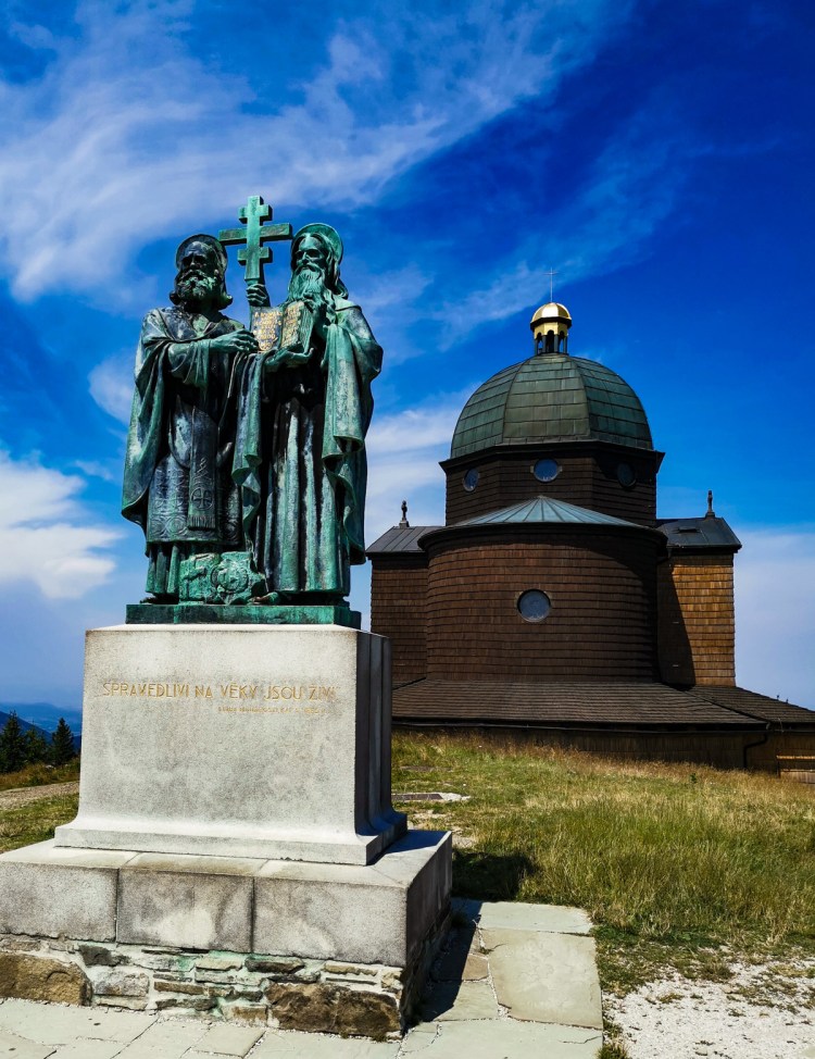
On the top you will find a church of Cyril and Methodius, which is the highest elevation religious building in the Czech republic. Close to it is a statue of Cyril and Methodius, two saints who brought the first alphabet to this region to spread Christianity through education. Appropriately, there is also a TV tower to spread another kind of information now.

We started from the huge parking lot and approached Radhošť from the other side (not the direction of all the tourists) and made a very long ride down to the point 2. From there it was a pretty strenuous fight uphill to gain 500 m to the top of the mountain. Even though most of the ride was bikeable, the path was pretty rough. And the last 300 m to the top were so steep that after one of us stopped, he was not able to start on the bike again and had to walk the rest of it.

On the way from the point 6 to the finish you will slowly weave between walkers, children and dogs. You will also see the statue of the pagan god Radegast which gave to this mountain its name.

https://en.mapy.cz/s/bezomevove 18 km 570 m elevation gain

Beskydy – Valašská Bystřice

Not too far from the industrial town of Ostrava lies the Moravian–Silesian Beskyds mountains with a small part reaching Slovakia. It lies on the historical division between Moravia and Silesia, hence the name. Using the site called Amazing Places in Czech Republic (https://www.amazingplaces.cz/en/business) we found a place to stay at the last minute in a tourist town called Čeladná for our rides through Beskydy. Our place was in a lovely location but there are so many interesting holiday homes through out the area and next time we might choose the town of Rožnov pod Radhoštěm. You should definitely visit the open air museum of local architecture, which is the largest of its kind in Europe.

We started our trip at Valašská Bystřice, a village stretched along the river Bystřice. During this ride you will never cross any tributaries of this little river, rather you will ride around all 78 of them.

Our ride was one of the most scenic of the summer, but the stretch from point 2 to point 3 was one of the most challenging ones. However, if you do not insist on riding everything and are not shy to walk your bike every now and then, then you will enjoy many views and you probably won’t meet anybody during the whole time there. The disadvantage of that is that the only place for a refreshment is at Santov, which is a very pleasant restaurant with a beautiful view of the countryside.

https://en.mapy.cz/s/popacagohu 28 km 668 m elevation gain

Beskydy – Šance Dam

The Beskydy Mountains are also known as the Beskid Mountain or Beskids for short.  This is a massive mountain range (outer part of the Carpathians) that covers 600 km in length and crosses from Poland to the Czech Republic, Slovakia, and the Ukraine. The area we wanted to explore is about a 6 hour drive from Prague and we took this as a three day trip. There are a number of peaks in this region but there’s none more famous than it’s highest peak, Lysá Hora. Although we were there to bike, we would easily go back to hike throughout this gorgeous area.

We started this ride on a small unofficial parking spot in the saddle under the mountain Malý Smrček (Little Spruce). After a long ride downhill we followed the road along the dam Šance (Chance) built in 1960’s, which is used as a source of drinking water and therefore is not available for any kind of recreational activities. The ride along the lake will take you on a nicely maintained road to the village Staré Hamry which was built for the people from the village destroyed by the dam. On the way you should stop at point 2, on the bridge in Masaryk’s valley. If you are lucky, you may see a big fish passing leisurely under.

Another point not to miss is the memorial to Maryčka Magdonova, the hero of the famous poem of Petr Bezruč about the girl trying to take care of her younger siblings after parents death. As in many Czech stories she did not succeed and ended her life.

From point 5 you will have to ride on pretty busy road up to the point where you will turn left to follow cycling road 6178. You may take a break at the point 6 to have some beer or Kofola – this is basically the only place to have some refreshment. This bike path will lead you up and down through the “bishop’s forests” via well maintained road. This is where I learned that the Czech Catholic Church was awarded over 140,000 hectars of forest lands in restitution after communism in 2012. You may also notice the memorial to the resistance group Wolfram which was sent here during the World War II from England.

Even though this ride had used a lot of our battery charge, we decided to climb to Malý Smrček and use up the rest of the charge. However, the last 300 m were not rideable so we had to finish the climb by walking. We expected a nice panoramic view, but the only thing we found there was another geocache.

https://en.mapy.cz/s/gurebudepa 42.5 km 910 m elevation gain

Lednice, Southern Moravia

The village of Lednice is one of the most popular destinations in Southern Moravia. It is not permitted to bike through the beautiful park – with a small exception, which of course we utilized. This easy trip will lead you through relatively flat countryside at times following the meandering blind branches of the Dyje river. That part of the trip is favorite dwelling of swarms of mosquitoes, so a repellent spray bottle is recommended, especially if you are stopping to take photos.

As the start we selected a parking lot in the sleepy village of Sedlec allowing us to ride a circle of 35 km with little elevation which we conquered at the very beginning. After point 2, your ride will be either downhill or flat. When you reach point 4, you can decide to park your bike and visit the castle Lednice on foot or take a ride along the inner wall of the park all the way to the Minaret (5). This part, unlike the rest of the park, is not forbidden to biking (even though on the map it is marked red). Continuing around outer fence of the park you will reach the Januv Hrad (7), an artificial ruin designed and built by the inventor of pencil J.L.Hardtmuth in 1801-1808, a long time before fake ruins became popular in Disneyland. He also built the minaret nearby.

The ride continues along the ponds of Lednice. You should stop at Apollo’s temple at point 9, which can be easily missed if you ride too fast. The temple “U tří gracií“ at point 11 will not be easy to spot. You can also see the remnants of fortifications of Czechoslovakia built in 1937 at point 10 or just after the bridge after point 7.

Link for the map is here https://en.mapy.cz/s/cetoforofo

Šumava – Nová Pec

Šumava National Park is one of the four national parks of Czech Republic.  The other three are Krkonoše, Podyjí, and Česke Švýcarsko. Characteristics of the natural environment: almost 85% of the area is forested in the central part. At higher altitude locations, there are remnants of primeval forests, abundant wetlands and raised bogs and glacial lakes. Many protected species of fauna and flora are relicts of the Ice Age.  According to my bad math the park is about 7% of the size of Yellowstone National Park which is where I grew up.  So I can appreciate the zoning they need to do in Šumava so not to overrun it with tourists. It means we can bike through but still see the tranquility of the forest and meadows from a distance.

An interesting thing I learned about the Vltava is some of the smaller rivers that feed into it like the Studená (cold) and Teplá (warm) Vltava being of different temperatures. We actually felt it during our boat trip earlier when we passed through the merge of those waters and could dip our hands on the opposite sides of the boat.

The next attraction on this trip was to see the Schwarzenberg canal which was used to float timber from 1793 to 1962 and is 44 km long.  At present only 15 km has been reconstructed as a technical monument.

After a long basically flat ride along Vltava to point 2, we climbed to the beginning of Schwarzenberg’s canal at point 3, where you can see the memorial to Mr. Rosenauer, the main architect of this monumental construction. You will be able to appreciate the size of this canal on the ride down along this waterway. At point 4 you should not miss the entrance to the channel tunnel, where it was necessary to go underground to find the way for the water to flow.

https://mapy.cz/s/hatojerafe 46 km with 275 m elevation gain

Šumava – Kvilda

The Bohemian Forest, known as Šumava is a low mountain range that creates a natural border with Czech Republic, Germany and Austria.  This region has a complicated history as part of the Iron Curtain large areas were stripped of human settlement. The unique circumstances led to preservation of this region making it a beautiful place to visit.

In fact we have gone there three times over the summer. The first time was in early June as we had a special permit to canoe on the river Vltava.

The other two visits were to ride in different areas of the park as the bike trails are some of the best in this country with over 500 km of hiking and biking trails. Of course some of the entrances into the park were busy and we had to share the mostly paved routes with hikers. However, it doesn’t take long to leave them behind and feel the vastness of the area.

Our first bike trip was at the end of July just as it was heating up in Prague we headed to the mountains.  We stayed in the town of Prachatice at the Prachatice Pivovar (brewery).  The room was really nice and the dinners at the brewery were delicious. We would recommend this place. And, by the way, do you know that the first American saint was born in Prachatice?

We drove to the parking area in the town of Kvilda. This cute village is an obvious tourist destination for bikers, hikers, skiers and has plenty of accommodation and restaurants.  There are also a few places to rent bikes.  It was a perfect place to go during the heat wave as this area is known to be one of the coldest places in all of central Europe.

Midway through our bike trip we stopped in the town of Modrava for lunch. This town is quite popular for its brewery and, surprisingly, for the kangaroos roaming in the little enclosure. In the summer we strongly suggest you try the hot raspberries with ice-cream (maliny se zmrzlinou).  We enjoyed it so much we made sure to return once again in September.

The first part of our ride was steep as we were going to see the source of the Vltava River which runs through Prague. This ‘pramen’ or spring is quite small and it is the obvious destination for the hikers.  It is only a 6 km hike to the spring from Kvilda. After that point the crowds of tourists thinned down almost to none. After you reach point 3, you can decide to go to point 4 to have a panoramatic view from Černá hora. Even though that the map shows the path 3 to 4 as forbidden for bicycles, we did not see any sign and went in with our bikes. A little after point 3 the road will lead you on a long downhill slope, which is marked with a warning sign for bikers – we would not recommend to go very fast! From the point 5 to Modrava you will follow Modravský potok (potok means stream) in a nice valley on the paved road. And again, you will see many more hikers coming from Modrava.

After that we followed Roklanský potok through the most beautiful, prototypical “Šumava valley”, on a nice paved road to point 7. After a little uphill ride to point 8 you should make a break and visit Tříjezerní slať (a three lake moor) to get the feeling how a lot of Šumava wet lands look like. After ride downhill you will then follow Vchynicko-Tetovský kanál (channel) which was used for transporting wood logged in the forests. The end of the trip repeats, as we are trying to avoid roads, on the road through Modrava back to Kvilda.

https://mapy.cz/s/pejeladava 43 km with 598 m elevation gain


Kolín to Týnec

Nice flat ride along Labe from a historic town of Kolín to Týnec nad Labem and back. We started at a parking lot of the supermarket Billa at Náměstí Republiky. After crossing the railroad and Labe using an interesting modern bridge at point 2, you will join the Elbe route (Labská cyklostezka). This bike path goes from Vrchlabí to Hamburg in Germany. It is one of the major bike path projects in Europe. However, the part you will be using is not the most representative piece.

Part of the trip will go on the pretty busy road number 322 and 327. When you enter the road 322, you can follow it to Týnec and across the bridge over Labe. But we like to go off the major road as soon as possible. Therefore we suggest that you exit this road ASAP. However, do not take the first exit left in Lžovice as that is a blind road. Rather take the second (or third, or fourth) and it will take you through a little loop around Týnec and you will be able to visit the bike friendly Pizzeria Mates. On the way back you will join yellow tourist mark at point 6 and follow it all the way to Kolín. At point 7 you will have to open a little gate across a small bridge and carry your bike for a little bit.

If you are lucky and weather is reasonable for swimming, you can take a little dip at point 3, a flooded active sandpit. Do not miss the opportunity to look at the Church of Saint Bartholomeus with its rich history going back to 13th century.

https://en.mapy.cz/s/beheposotu 33 km, 99 m elevation gain. To see this ride in context, check our interactive maps.

Krčský les and Hostivař

It is actually surprising how can you avoid riding on the streets and regular roads while biking through Prague. Sometimes we can even imagine we are in a different city. With warm summer weather our main destination was to take a swim in the Hostivař reservoir in Prague, so the question was where to start our circular ride. We enjoyed this ride in particular because you pass by so many different water features.

Hostivař reservoir is really a great recreation area. Easy to get to by public transportation and has many different walks to take in nature. You can swim for free on part of the lake or you can pay to go into the area that includes a beach and several food options. Although it is mostly families enjoying the water and beach, there is a section reserved for a nude beach.

A good starting point we found was on a dead end street in front of Thomayer’s hospital. Polly had not so fond memories of this hospital 8 years ago, but was happy to see the wild muflon (sheep) were still in the woods close to the buildings.

After a little climb through Krč forest we followed a modern bike path and zigzag through the side streets of the neighborhood of Spořilov. Then we meandered along the stream called Botič in a little natural park. The route goes over the stream by a little bridge with stairs, which unless you are an expert rider you will need to make use of the ‘walk’ button on the e-bike.

When riding on this route be careful crossing Pražská street, which can be pretty busy. But then you will be on a pleasant bike path (points 5-8). If the weather is reasonable and the beach is open, you can cross the dam and enter the swimming area (points 6-7). Just note there is no biking inside of the fenced area.

You should pay good attention to your ride between where the path is pretty narrow (points 8 and 9) and watch your head at the underpass which is quite low (point 13). Also you might notice that it is not just your perspective that the tunnel is getting smaller but a reality as you go through. We thought the best part of the trip is between point 14 to 15. If you think you want to save your battery and cut the trip short you can follow the yellow tourist trail back to the finish at point 15. Otherwise you can climb to the top of Krčský les and enjoy the long ride downhill as we did.

https://en.mapy.cz/s/futoratoda – 28 km with very little elevation gain. Any bike would be fine for this ride.

Nižbor

Nižbor became one of our favorite ride starting points. Not only because the area around Berounka is magical and full of bike routes, but also because we found an ideal spot for regaining our strength after a long trip – a restaurant Zastávka Nižbor. This establishment has the atmosphere of the beginning of the last century. It used to be an abandoned railroad structure which was saved from destruction by Mr Tomáš Hanák (aka Czech Paul Newman). The story of this place is available on internet.

The first ride from here started on the blue tourist mark, which at the point 5 turned into red mark. This part may be a little tricky after a rainy days, when you can encounter quite a bit of mud. Similar situation may be between points 10 and 14. But in the rainy days you can just follow marked bike roads (which we are usually avoiding when there is an alternative going through the woods).

A good point to have a Kofola, or something else, is at the village Žilina. Look on the right hand side just after crossing the road in the middle of the village. Here you can decide to go directly to point 12, if the ride from 2 to 5 was really muddy. After point 16 we could not avoid the regular road, which may unfortunately be a little busy.

https://en.mapy.cz/s/joganezoro, 37 km, 586 m elevation gain. To see this ride in context, check our interactive maps.

Doksy, Máchovo Jezero

This is a good ride for a nice summer day. If possible avoid the weekend since Máchovo jezero is a popular destination for all kinds of water sports. This lake was created on the order of Karel IV in 1366. It was only named in 1961 after Karel Hynek Mácha, the famous and controversial Czech poet. Most of the ride goes on nice forest roads, but you should not be surprised by little pockets of soft sand. If you want to take a plunge into the lake, there is relatively good access to water at point 4, called the “Swamp”. You can choose a shortcut from point 2 to 4 following the yellow tourist sign which would lead you through the swamp. It is quite an interesting way where you may encounter a narrow bumpy pathway. It is rideable but not recommended for bicycles. After point 7 you may be wondering what was this huge parking lot used for. It was a lot used by the army for their in the field exercises. This area was in the past closed to the public and was dedicated to military use. Later you will be riding along the military airport Hradčany and former military town Ralsko. The military use of this area by Russian occupational forces after 1968 left this area heavily contaminated and it took more than 20 years to correct the situation.

On the left side of the road leaving from Ralsko you may stop at the rest area and view the stone creations in the form of a picnic table. At point 10 you will see Fleslovo jezírko (a tiny lake) which is quite an interesting natural feature, an unexpected phenomenon in this sand-based countryside. This little lake was badly damaged by the army which used it as a washing spot for their nasty vehicles. And if you are into geocaching, you should definitely look for one at this spot.

https://en.mapy.cz/s/nupasunere 40 km, 215 m elevation gain

Hrubá Skála – Český Ráj

Český Ráj or Bohemian Paradise is a Protected Landscape Area and a perfect day trip from Prague for hikers and bikers. We typically visit this are at least 3 times a year because it really is paradise. It was declared in 1955, as the first nature reserve in Czechia. At first, it was 95 square kilometres in area; today it is almost 182 km². When walking through the area you will encounter lots of sandstone stairs and climbing up and down to enjoy the different features and views. Many climbers come to this area so you will see hooks in some of the rocks. It is a very popular place so its best to come on weekdays.

We can recommend the parking lot at Hrubá Skála as the starting point of the bike ride through Český Ráj. This trip combines pleasant rides on nice asphalt roads and reasonable forest roads mixed with crazy unrideable pieces of paths where you will have to walk your bike… exactly the way we like it. We specifically mention the places where you should pay special attention or choose another way around.

The first such place is the stretch between point 8 and 9 where you will probably decide to walk your bike for a little bit. Not paying enough attention may result in a little resting in a soft grass meadow (see picture below). However, the real challenge can be found around point 12. For some reason, the path on the map is not representing the real situation. If you would try to go through the ruins of the castle Chlum as shown on the map, you will realize that it is impossible to do with your bike. You will have to choose the path through the openings in the stone walls on the right, which is obviously the way the people are walking through. We do not recommend to try to bike it, just be patient and walk your bike through this stretch. If you want to avoid this difficult part, continue on the road to village Kadeřavec and then turn left to Všeň.

https://en.mapy.cz/s/namabuzeso 31 km with 600 m elevation gain

Nymburk to Lysá nad Labem

The town of Nymburk, 28 miles east of Prague is worth a visit and a walk around. The main feature of the town is the Gothic brick Saint Giles Church. This church, together with the preserved buildings of the Nymburk fortification, is a unique example of brick Gothic architecture in the Czech lands. The dominant of the square is a rare Renaissance Town Hall. Besides town walls, the town is also dominated by the Road Bridge (cultural heritage) from 1913, which connects the town center with a town part of Zálabí. Among the important cultural monuments of Nymburk is also Turkish tower, Plague Column, Chapel of St. John of Nepomuk, Bohumil Hrabal Grammar School, Nymburk Synagogue, Water Tower, and Old Fisher House.

This trip was our last ride before we traded in our Apache Wakan bikes which served us well for nine years and upgraded to electric Apache MTBs. When we rode here, we had no idea that we will upgrade soon and that we will be writing about our trips. So we selected an easy ride with basically no elevation gain. The first notable stop of this ride was a graffiti sprayer’s dream – an abandoned warehouse with a lot of walls to put your creation on. We had the luck to talk to a homeless “guide” who explained to us how this hall is used. We recommend the visit only during the daytime!

We started our ride on the right bank of Labe (aka Elbe) river from the popular parking lot next to a bridge in Nymburk. There is a nice bike path in Nymburk, which slowly becomes a narrow path through the meadows. You may visit the ruins of the castle Mydlovar in the protected area Mydlovarský luh (point 3). At point 4 you will be riding along lake Ostrá which may be a good destination for swimming in the summer. Unfortunately, the road along the bank of Labe to the bridge in Lysá was closed, so we had to use the regular road to Litolský bridge, now called the bridge of Bohumil Hrabal (see picture below). The ride back from Lysá follows the river closely with the exception of riding through Hradištko, the beloved village of Bohumil Hrabal.

After crossing the bridge back to the right side of the river, you may stop at point number 7 and try to find the geocache. If you don’t know about the geocaching game, you can find out what it is here – http://www.geocaching.com, and at this point, you may find one of the nicest geocaches we found.

https://en.mapy.cz/s/dugukecalo 36 km no elevation gain. For all rides see the map.


https://en.mapy.cz/s/gatetavovo

Translate »